Call Chris Power: 0431629464 | E-mail: chris@rastermatics.com.au| ABN 54 984 366 851

Mapping Bushfire Scar - Cape York Peninsula

Landsat data was used to map the 2013 bushfire season for Western Cape York. The images below show how extensive is the Northern bushfire season.

Rastermatics Bushfire Scar Extraction Methodology builds a profile of bushfire activity.
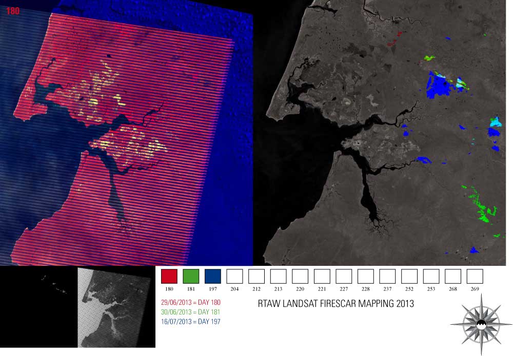
Rastermatics Bushfire Scar Extraction Methodology builds a profile of bushfire activity.

Rastermatics Bushfire Scar Extraction Methodology builds a profile of bushfire activity.

Rastermatics Bushfire Scar Extraction Methodology builds a profile of bushfire activity.

Rastermatics Bushfire Scar Extraction Methodology builds a profile of bushfire activity.

Rastermatics Bushfire Scar Extraction Methodology builds a profile of bushfire activity.

Rastermatics Bushfire Scar Extraction Methodology builds a profile of bushfire activity.

Rastermatics Bushfire Scar Extraction Methodology builds a profile of bushfire activity.

Rastermatics Bushfire Scar Extraction Methodology builds a profile of bushfire activity.

Rastermatics Bushfire Scar Extraction Methodology builds a profile of bushfire activity.

Rastermatics Bushfire Scar Extraction Methodology builds a profile of bushfire activity.

Rastermatics Bushfire Scar Extraction Methodology builds a profile of bushfire activity.

Rastermatics Bushfire Scar Extraction Methodology builds a profile of bushfire activity.

Rastermatics Bushfire Scar Extraction Methodology builds a profile of bushfire activity.

Rastermatics Bushfire Scar Extraction Methodology builds a profile of bushfire activity.

Rastermatics Bushfire Scar Extraction Methodology builds a profile of bushfire activity.

Contact Chris Power